Surveying students from the WA School of Mines, Curtin University, have ‘rediscovered’ former thriving townsites in the Goldfields while treading in the footsteps of WA’s pioneering surveyors.
 During the recent two-week student survey expedition, a group of fourth-year Spatial Sciences students undertook field work between Menzies and Leonora while receiving valuable mentorship from experienced senior and retired surveyors as well as Curtin staff.
Among the surveying project sites were former towns such as Malcolm, Niagara and Kookynie. In addition, students used the latest surveying technology to map a number of disused water catchment areas including Karalee Rocks, Niagram Dam and Malcolm Dam; and surveyed the Gwalia State Hotel and the original Sons of Gwalia steam winder engine and headframe located within the Gwalia museum complex.
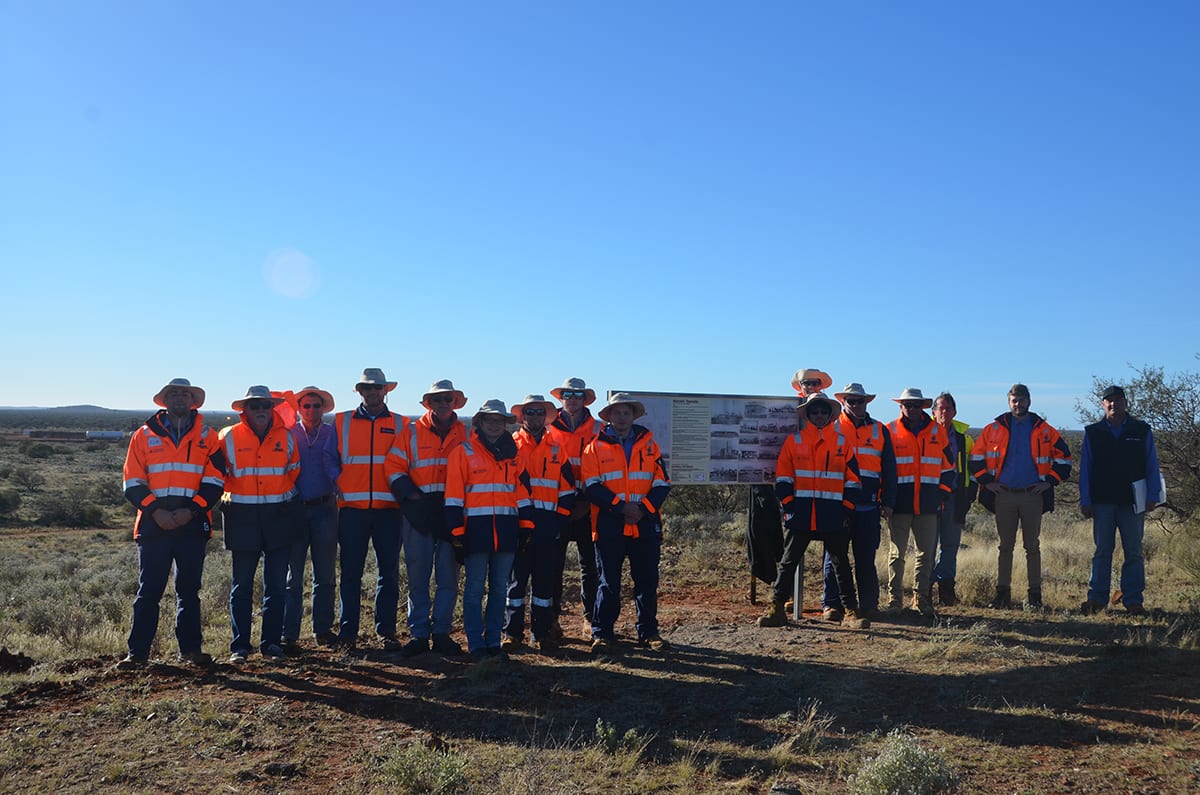
While in Malcolm, an abandoned town site 20km east of Leonora, students erected a large sign overlooking the old town site that featured photographs of what the town used to look like, to enable passersby to envisage its rich history.
Tony Snow, Senior Lecturer in the Department of Spatial Sciences at the Curtin WA School of Mines, said the goal of the fully-sponsored expedition was to provide graduating surveyors with the opportunity to put their skills into practice in the field.
“The expedition allows students to take their classroom knowledge and apply their surveying and organising skills in real world applications, whilst located in outback and remote areas of WA,” Mr Snow said.
“Participants benefit enormously from the experience and become better future surveyors as a result.”
Mr Snow said the expeditions, which run every two years, typically retrace the footsteps of early surveyors and in the past had explored the Kimberley, Canning Stock Route, Rabbit Proof Fence, Walga Rock and Mt Magnet.
“This has a twofold purpose — firstly it enables us to experience in a very small way the hardships the early surveyors endured to achieve their goals,” he said.
“Secondly, as some of these early surveys have never been re-surveyed, the results are used to verify the original work and enhance the State Geodetic Survey Network in these areas.”
Fourth-year Spatial Sciences student and student survey expedition leader Alex Gardner said the expedition was a great way to see how the art of surveying had changed over time, leading to greater efficiency.
“Not many people realise how long some of these surveying jobs used to take in these remote areas,” Mr Gardner said.
“Surveys that would originally have taken months of work can now be done in several days thanks to the technology we have now.
“For example, the early surveyors didn’t have the benefit of scanners, drones, GPS or computers, all of which have helped to improve the accuracy and speed of surveying. Nonetheless, they still obtained some impressive results.
“These days you’re still in the middle of nowhere at times and experiencing difficult conditions, but surveying today definitely has more perks than the past,” he said.
Further information can be found at http://www.wastudentsurveyexpeditions.com/.